Map & Directions
Location
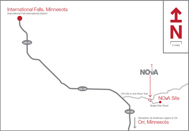
How to get there
Flying:
The closest airport to the Ash River Trail is in International Falls. There are 3 flights per day from Minneapolis arriving at 10:30 a.m., 4:00 p.m. and 10:45 p.m. It is ~26 miles from the airport to the turn-off to the Ash River Trail. It is well marked. It is an additional 5 ½ miles down the Ash River Trail to the start of the new Bright Star Road. You can also fly into Minneapolis-St. Paul International Airport, which is a 275-mile drive, or Duluth International Airport, which is 135 miles away.
Driving from the South:
If driving from Minneapolis, take I-35 north to exit 237 in Cloquet and take Hwy 33 north 20 miles. Merge onto US-53 and continue north through Virginia for 113 miles to Ash River Trail (CR-129). Drive 5.5 miles to the Ash River Recreational Trail and the beginning of Bright Star Road.
Driving from the North:
Drive south on US-53 to the Ash River Trail (CR-129). Drive 5.5 miles to the Ash River Recreational Trail and the beginning of Bright Star Road.