 |
|
Dear Fermilab...
Hello. I am a physics major at Colgate University in Hamilton, NY, and am working on a group project dealing with the geometry of paths through earth. Our professor would like us to connect the work we have done with geographic coordinates to the MINOS project that is being done at Fermilab. I was wondering if you wouldn't mind answering a few questions to assist me with my project:
1.Why was the Soudan mine chosen as the place for the receptor?
3.Did you have to take irregularities in the surface of the earth into account? 4. Does the curvature of the earth affect the experiment or your planning of it at all? 5. How do you go about calculating how far beneath the surface of the earth the beamline is at any point, and does it matter to you just how deep in the ground it is?
I would greatly appreciate as quick a response as possible, since our project is due next week. Thanks in advance for taking the time to answer these questions. I hope they aren't too naive or unclear. Jessica Frank
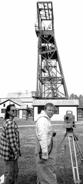
1. Why Soudan?
(b) A deep-mine environment is imperative to shield out most of the cosmic ray muon background. (c) Already present in the Soudan mine is a circa 1000-ton detector, SOUDAN-2, that has been operating for over a decade searching for nucleon decay and atmospheric neutrino phenomena. A "laboratory infrastructure" was present with a staff of proven capabilitiesó a significant cost factor. (d) The SOUDAN-2 research collaboration was eager to participate in the much larger program of MINOS investigations; they were prime movers in the proposal. (e) There was an intense technical competition among several proposals, including one with another mineóand MINOS survived!
2. Beam correctly pointed?
The only adequate technique is exquisitely precise surveying, based upon modern GPS procedures to locate both Fermilab and Soudan Mine positions within few-centimeter accuracies in latitude, longitude, and altitude. The "altitude" is itself a complex matter since the earth is not exactly spherical, being flattened at the poles. (For that matter, it isn't precisely ellipsoidal, either!) The mathematics involved in calculating directions is thus basically spherical trigonometry, modified to accommodate the quasispheroidal "figure of the Earth." The discipline for doing all this, as you surely know already, is called geodesy. The initial test of the quality of the surveying and the tunnel and beam-direction alignment will be in the actual detection of Fermilab neutrinos at Soudan, both in the MINOS detector and in the present Soudan-2 detector. However, simply seeing neutrinos will not say what part of the beam "spot" is hitting the detectors. This must be determined in order to know the neutrino energy spectrum. At present, the success of the MINOS experiment depends critically upon confidence that the basic geodesy, surveying and construction operations have been done correctly. The real expert at Fermilab who, with his associates, is responsible for actually carrying out this beam-aiming program is Dr. Wesley Smart. 3. Irregularities in Earth's surface? Insofar as the quasispheroidal shape of the earth is an "irregularity" the answer, as described in Item 2. above, is "yes." Local irregularities in the mass distribution near a field surveying station can also affect the direction of plumb bobs, and the critical "aiming" measurement at Fermilab will take such potential effects into account. Since the neutrino beam passes in a straight line underground over all of its trajectory to the mine, and since it is negligibly impeded by "earth" in any case, the surface irregularities have no effect on it. 4. Earth's curvature? I think this issue is also covered in Item 2., above. Yes, the Earth's curvature must be accommodated in detail if one is to aim the beam correctly from Fermilab to Soudan. 5. How far down? Does it matter? The proper geodesic calculations outlined in Item 2 also yield the depth of the beam at intermediate points. These depths can be approximately estimated by assuming a spherical Earth and working out the chord between the initial and final (lat, long, alt) points. So far as the neutrinos are concerned this depth is of negligible significance; it may be, perhaps, of some use politically to be able to reassure population centers that the "beam" (albeit almost totally non interactive) passes by at a comfortable distance underground. I am delighted that you and your group have undertaken your project! It is a subject of great importance to us MINOS folk, and I wish you every success with your report. Sincerely, Richard H. Milburn |
 I am very happy to respond to your perceptive questions about the MINOS experiment and its geodesic implications. I am a MINOS collaborator and a physics professor at Tufts University. I have been concerned with the beam-aiming problems for much of the past decade and will try to give you and your group some insight into the issues. You have obviously thought through many of the problems already so I'll try to be succinct ó as succinct as a professor can be! ó in reply.
| last modified 1/14/2000 email Fermilab |
FRLsDFx9eyfrPXgV